-
×
 National Geographic 223 North Cascades National Park Map Washington
1 × $8.06
National Geographic 223 North Cascades National Park Map Washington
1 × $8.06 -
×
 National Geographic 501 Moab South Trail Map Utah Gear
1 × $9.80
National Geographic 501 Moab South Trail Map Utah Gear
1 × $9.80 -
×
National Geographic 1013 Tahoe Rim Trail Map Gear
2 × $11.06
-
×
National Geographic 132 Gunnison - Pitkin Map Colorado
1 × $9.92
-
×
National Geographic 211 Arches National Park Map Utah
1 × $10.91
-
×
National Geographic 703 Manti La-Sal National Forest Map Utah
1 × $9.32
-
×
National Geographic 204 Lake Mead National Recreation Area Map Gear
1 × $10.91
-
×
National Geographic 130 Salida - St. Elmo Map Colorado Gear
1 × $12.41
-
×
National Geographic Gear 500 Moab North Trail Map Utah
1 × $9.68
-
×
National Geographic Gear 303 NW Yellow/ Mammoth Map Wyoming Montana
1 × $9.44
-
×
National Geographic 228 Shenandoah National Park Map Virginia
1 × $9.68
-
×
National Geographic 322 Mount Whitney Trail Map Gear
1 × $9.92
 National Geographic 501 Moab South Trail Map Utah Gear
 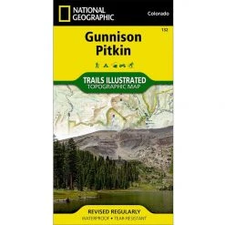 National Geographic 132 Gunnison - Pitkin Map Colorado
  National Geographic 211 Arches National Park Map Utah
  National Geographic 703 Manti La-Sal National Forest Map Utah
  National Geographic 204 Lake Mead National Recreation Area Map Gear
  National Geographic 130 Salida - St. Elmo Map Colorado Gear
  National Geographic Gear 500 Moab North Trail Map Utah
  National Geographic 228 Shenandoah National Park Map Virginia
  National Geographic 322 Mount Whitney Trail Map Gear
 Sale!

National Geographic 104 Idaho Springs – Loveland Pass Colorado The 10 Essentials
Original price was: $11.95.$9.68Current price is: $9.68.
- Buy quality, buy with us.
- Online assistance, always just a message away.
- Peace of Mind with Every Purchase
- Get the quality you deserve, for less.

The most comprehensive recreational map for: Arapaho and Pike National Forests; Mount Evans Wilderness; Idaho Springs, Georgetown, Montezuma, Keystone, Clear Creek, Chicago Lakes, and Summit Lake; 14ers: Mt. Evans, Mt. Bierstadt, Grays and Torreys peak; Loveland, Webster, Juniper and Guanella passes; Ski Areas: Arapaho Basin, Loveland and Keystone.
- Approximately 4″ x 7 1/2″ folded; 22″ x 32″ fully opened
- Scale = 1:40,680
- Map revised – 2003
- Printed on waterproof, tear-resistant paper.
More than just a map, National Geographic Trails Illustrated topographic maps are designed to take you into the wilderness and back. Printed on tear-resistant, waterproof material, this map can go anywhere you do. Each map is based on exact reproductions of USGS topographic map information, updated, customized, and enhanced to meet the unique features of each area. The maps include valuable wilderness tips and Leave No Trace guidelines, along with updated trails, trailheads, points of interest, campgrounds, and much more. With a new color palette and stunning shaded relief, backcountry navigation has never been easier.
Be the first to review “National Geographic 104 Idaho Springs – Loveland Pass Colorado The 10 Essentials”
Related products
Sale!


Original price was: $7.95.$6.44Current price is: $6.44.
This product has multiple variants. The options may be chosen on the product page
Sale!

Original price was: $14.95.$11.51Current price is: $11.51.
Sale!
Original price was: $14.95.$12.56Current price is: $12.56.
Sale!

Original price was: $14.95.$11.06Current price is: $11.06.
Sale!
Original price was: $14.95.$11.06Current price is: $11.06.
Sale!

Original price was: $11.95.$8.72Current price is: $8.72.
Sale!

Original price was: $14.95.$10.91Current price is: $10.91.
Sale!

Original price was: $11.95.$9.44Current price is: $9.44.
Reviews
There are no reviews yet.