-
×
 National Geographic Gear 3302 Iceland - Adventure Map
1 × $11.06
National Geographic Gear 3302 Iceland - Adventure Map
1 × $11.06 -
×
 National Geographic 1013 Tahoe Rim Trail Map Gear
1 × $11.06
National Geographic 1013 Tahoe Rim Trail Map Gear
1 × $11.06 -
×
Kelty Grand Mesa 4 Tent Gear
1 × $91.99
-
×
National Geographic 223 North Cascades National Park Map Washington
1 × $8.06
-
×
National Geographic 1302 Colorado Topographic Map- 14ers North Gear
1 × $10.91
-
×
National Geographic 211 Arches National Park Map Utah
1 × $10.91
-
×
National Geographic 501 Moab South Trail Map Utah Gear
1 × $9.80
-
×
National Geographic 130 Salida - St. Elmo Map Colorado Gear
1 × $12.41
 National Geographic 1013 Tahoe Rim Trail Map Gear
 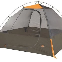 Kelty Grand Mesa 4 Tent Gear
  National Geographic 223 North Cascades National Park Map Washington
  National Geographic 501 Moab South Trail Map Utah Gear
  National Geographic 130 Salida - St. Elmo Map Colorado Gear
 Sale!

National Geographic 116 Hahns Peak – Steamboat Lake Map Colorado Gear
Original price was: $11.95.$9.68Current price is: $9.68.
- Buy quality, buy with us.
- Online assistance, always just a message away.
- Peace of Mind with Every Purchase
- Get the quality you deserve, for less.

The National Geographic -Trails Illustrated folded map is your essential guide for outdoor exploration in Colorado’s Hahn’s Peak/Steamboat Lake area. The brilliantly illustrated topographical representation shows all trails, campsites, and recreational features, plus relevant info on wildlife, history, geology, and archaeology.
Coverage includes Routt National Forest. Mt.Zirkel Wilderness. Pearl Lake State Pk. Hahn’s Peak and Pearl. Steamboat, Big Creek, Boettcher, Gilpin and Bear lakes. Frying Pan Basin. Includes portions of the Continental Divide Trail.
All data is updated to reflect road closings, new trails, and campground relocation.
Printed on waterproof, tear-resistant material with a plastic coating that offers supreme durablity for your next outdoor adventure.
Measures 4″ x 9″ folded and 28″ x 32″ fully opened.
Be the first to review “National Geographic 116 Hahns Peak – Steamboat Lake Map Colorado Gear”
Related products
Sale!

Original price was: $14.95.$10.91Current price is: $10.91.
Sale!
Original price was: $11.95.$9.20Current price is: $9.20.
Sale!

Original price was: $14.95.$11.51Current price is: $11.51.
Sale!

Original price was: $14.95.$12.26Current price is: $12.26.
Sale!

Original price was: $14.95.$10.91Current price is: $10.91.
Sale!

Original price was: $14.95.$10.91Current price is: $10.91.
Sale!

Original price was: $14.95.$11.66Current price is: $11.66.
Sale!

Original price was: $11.95.$8.84Current price is: $8.84.
Reviews
There are no reviews yet.