-
×
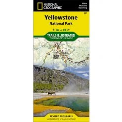 National Geographic 201 Yellowstone National Park Map Idaho Montana Wyoming Gear
1 × $11.06
National Geographic 201 Yellowstone National Park Map Idaho Montana Wyoming Gear
1 × $11.06 -
×
 National Geographic Gear 247 Carlsbad Caverns Map New Mexico
1 × $9.92
National Geographic Gear 247 Carlsbad Caverns Map New Mexico
1 × $9.92 -
×
National Geographic 803 Lake Tahoe Basin Topographic Map-California/Nevada
1 × $8.84
-
×
National Geographic Gear 225 Big Bend National Park Map Texas
1 × $11.51
-
×
National Geographic 210 Canyonlands National Park Needles - Island Map
1 × $11.66
-
×
Activities Watersport Warehouse Rack Pad 24" Aero
1 × $25.87
-
×
National Geographic 204 Lake Mead National Recreation Area Map Gear
1 × $10.91
-
×
National Geographic Gear 1303 Colorado Topographic Map- 14ers South
1 × $12.26
 National Geographic Gear 247 Carlsbad Caverns Map New Mexico
  National Geographic 210 Canyonlands National Park Needles - Island Map
  Activities Watersport Warehouse Rack Pad 24" Aero
  National Geographic 204 Lake Mead National Recreation Area Map Gear
  National Geographic Gear 1303 Colorado Topographic Map- 14ers South
 Sale!

National Geographic 230 Hawaii Volcanoes National Park Map
Original price was: $11.95.$8.96Current price is: $8.96.
- Buy quality, buy with us.
- Online assistance, always just a message away.
- Peace of Mind with Every Purchase
- Get the quality you deserve, for less.

On the island of Hawaii, Hawaii Volcanoes National Park includes two of the world’s most active volcanoes. This map includes the entire national park area, including Kilauea Caldera, Makaopuhi Crater, Napau Crater, Chain of Craters East Rift Zone, Kapapala, Hawaii Volcanoes National Park Wilderness, Kea’au, and an inset of Island of Hawaii. Includes UTM tick marks for use with your GPS.
- Approximately 4 1/4″ x 9 1/4″ folded; 25 1/2″ x 37 3/4″ fully opened
- Scale = 1:100,000 & 1:42,000
- Map revised – 2000
More than just a map, National Geographic Trails Illustrated topographic maps are designed to take you into the wilderness and back. Printed on tear-resistant, waterproof material, this map can go anywhere you do. Each map is based on exact reproductions of USGS topographic map information, updated, customized, and enhanced to meet the unique features of each area. The maps include valuable wilderness tips and Leave No Trace guidelines, along with updated trails, trailheads, points of interest, campgrounds, and much more. With a new color palette and stunning shaded relief, backcountry navigation has never been easier.
Be the first to review “National Geographic 230 Hawaii Volcanoes National Park Map”
Related products
Sale!
Original price was: $14.95.$11.06Current price is: $11.06.
Sale!

Original price was: $11.95.$9.92Current price is: $9.92.
Sale!

Original price was: $14.95.$12.41Current price is: $12.41.
Sale!

Original price was: $11.95.$8.84Current price is: $8.84.
Sale!

Original price was: $14.95.$12.26Current price is: $12.26.
Sale!

Original price was: $11.95.$9.80Current price is: $9.80.
Sale!

Original price was: $14.95.$11.51Current price is: $11.51.
Sale!

Original price was: $11.95.$8.72Current price is: $8.72.
Reviews
There are no reviews yet.