-
×
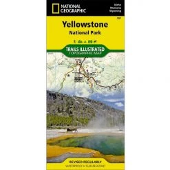
 National Geographic Gear 305 SE Yellow - Yellowstone Lake Map Wyoming
1 × $8.72
National Geographic Gear 305 SE Yellow - Yellowstone Lake Map Wyoming
1 × $8.72 -
×
 National Geographic 203 Guadalupe Mountains National Park Map Texas
1 × $10.91
National Geographic 203 Guadalupe Mountains National Park Map Texas
1 × $10.91 -
×
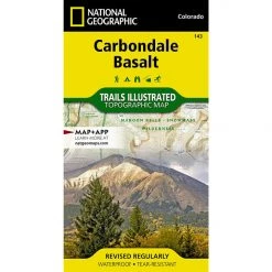
National Geographic 143 Carbondale Bassalt Trail Map
1 × $9.20
-
×
National Geographic Gear 500 Moab North Trail Map Utah
1 × $9.68
-
×
National Geographic Gear Texas Hill Country Destination Map
1 × $10.91
 National Geographic 203 Guadalupe Mountains National Park Map Texas
  National Geographic Gear 500 Moab North Trail Map Utah
  National Geographic Gear Texas Hill Country Destination Map
 Sale!

National Geographic 231 Kenai Fjords National Park And Chugach NF Map The 10 Essentials
Original price was: $11.95.$9.92Current price is: $9.92.
- Buy quality, buy with us.
- Online assistance, always just a message away.
- Peace of Mind with Every Purchase
- Get the quality you deserve, for less.

The National Geographic -Trails Illustrated folded map is your essential guide for outdoor exploration in Kenai Fjords National Park and Chugach National Forest area. The brilliantly illustrated topographical representation shows all trails, campsites, and recreational features, plus relevant info on wildlife, history, geology, and archaeology.
All data is updated to reflect road closings, new trails, and campground relocation.
Printed on waterproof, tear-resistant material with a plastic coating that offers supreme durablity for your next outdoor adventure.
Measures 4″ x 9″ folded and 28″ x 32″ fully opened. Scale 1:105,600.
Be the first to review “National Geographic 231 Kenai Fjords National Park And Chugach NF Map The 10 Essentials”
Related products
Sale!
Original price was: $11.95.$9.20Current price is: $9.20.
Sale!

Original price was: $14.95.$12.26Current price is: $12.26.
Sale!
Original price was: $14.95.$11.06Current price is: $11.06.
Sale!

Original price was: $14.95.$11.66Current price is: $11.66.
Sale!

Original price was: $14.95.$12.26Current price is: $12.26.
Sale!

Original price was: $14.95.$11.06Current price is: $11.06.
Sale!
Original price was: $11.95.$8.72Current price is: $8.72.
Sale!

Original price was: $11.95.$9.68Current price is: $9.68.
Reviews
There are no reviews yet.