-
×
 NRS Infinity Split Kayak Stern Flotation Bags Pair Gear
1 × $71.36
NRS Infinity Split Kayak Stern Flotation Bags Pair Gear
1 × $71.36 -
×
 Yakima SkinnyWarrior Cargo Basket Extension
1 × $98.99
Yakima SkinnyWarrior Cargo Basket Extension
1 × $98.99 -
×
National Geographic Gear 247 Carlsbad Caverns Map New Mexico
1 × $9.92
-
×
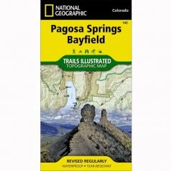
National Geographic 1302 Colorado Topographic Map- 14ers North Gear
1 × $10.91
-
×
MSR Windpro II Stove
1 × $97.16
-
×
National Geographic Gear 305 SE Yellow - Yellowstone Lake Map Wyoming
1 × $8.72
-
×
National Geographic 130 Salida - St. Elmo Map Colorado Gear
1 × $12.41
-
×
National Geographic 143 Carbondale Bassalt Trail Map
1 × $9.20
-
×
MSR Pocket Rocket Delux Backpacking Stove
1 × $58.36
 Yakima SkinnyWarrior Cargo Basket Extension
  National Geographic 1302 Colorado Topographic Map- 14ers North Gear
  MSR Windpro II Stove
  National Geographic 130 Salida - St. Elmo Map Colorado Gear
 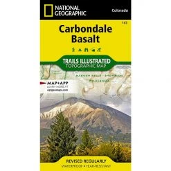 National Geographic 143 Carbondale Bassalt Trail Map
  MSR Pocket Rocket Delux Backpacking Stove
 Sale!

National Geographic 781 Tellico – Ocoee Rivers Map Tennessee
Original price was: $11.95.$9.20Current price is: $9.20.
- Buy quality, buy with us.
- Online assistance, always just a message away.
- Peace of Mind with Every Purchase
- Get the quality you deserve, for less.

This Trails Illustrated topographic map is the most comprehensive recreational map for Tennessee’s Cherokee National Forest, Southern Districts, Tellico and Ocoee Rivers, Cohutta Wilderness area.
Coverage includes Cherokee National Forest/Southern Districts, Cohutta wilderness areas, Ocoee Whitewater Center, Hiwassee State Scenic River, Ocoee Scenic Byway drive, Cherohala Skyway, Tellico Auto Wildlife Viewing Loop, John Muir National Recreation Trail,and more. Towns: Etowah, McCaysville. Joyce Kilmer Slickrock, Citico Creek, Bald River Gorge, Gee Creek, Big Frog, Little Frog.
- Approximately 4 1/4″ x 9″ folded; 25 1/2″ x 37 3/4″ fully opened
- Scale = 1:63,360
- Printed on waterproof, tear-resistant paper.
More than just a map, National Geographic Trails Illustrated topographic maps are designed to take you into the wilderness and back. Printed on tear-resistant, waterproof material, this map can go anywhere you do. Each map is based on exact reproductions of USGS topographic map information, updated, customized, and enhanced to meet the unique features of each area. The maps include valuable wilderness tips and Leave No Trace guidelines, along with updated trails, trailheads, points of interest, campgrounds, and much more. With a new color palette and stunning shaded relief, backcountry navigation has never been easier.
Be the first to review “National Geographic 781 Tellico – Ocoee Rivers Map Tennessee”
Related products
Sale!

Original price was: $11.95.$8.72Current price is: $8.72.
Sale!

Original price was: $14.95.$10.91Current price is: $10.91.
Sale!

Original price was: $11.95.$8.84Current price is: $8.84.
Sale!

Original price was: $11.95.$9.92Current price is: $9.92.
Sale!

Original price was: $14.95.$10.91Current price is: $10.91.
Sale!

Original price was: $14.95.$12.26Current price is: $12.26.
Sale!
Original price was: $11.95.$8.60Current price is: $8.60.
Sale!

Original price was: $11.95.$9.68Current price is: $9.68.
Reviews
There are no reviews yet.