-
×
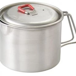 MSR Titan Tea Kettle
1 × $55.26
MSR Titan Tea Kettle
1 × $55.26 -
×
 National Geographic Gear 303 NW Yellow/ Mammoth Map Wyoming Montana
1 × $9.44
National Geographic Gear 303 NW Yellow/ Mammoth Map Wyoming Montana
1 × $9.44 -
×
NRS J-Hook Tie-Down Straps Kit Small 6 Feet
1 × $15.16
-
×
National Geographic Gear Texas Hill Country Destination Map
2 × $10.91
 National Geographic Gear 303 NW Yellow/ Mammoth Map Wyoming Montana
  NRS J-Hook Tie-Down Straps Kit Small 6 Feet
  National Geographic Gear Texas Hill Country Destination Map
 Sale!

National Geographic Gear 247 Carlsbad Caverns Map New Mexico
Original price was: $11.95.$9.92Current price is: $9.92.
- Buy quality, buy with us.
- Online assistance, always just a message away.
- Peace of Mind with Every Purchase
- Get the quality you deserve, for less.

The National Geographic – Trails Illustrated folded map is your essential guide for outdoor exploration in Carlsbad Caverns National Park. The brilliantly illustrated topographical representation shows all trails, campsites, and recreational features, plus relevant info on wildlife, history, geology, and archaeology.
All data is updated to reflect road closings, new trails, and campground relocation.
Printed on waterproof, tear-resistant material with a plastic coating that offers supreme durablity for your next outdoor adventure.
Measures 4″ x 9″ folded and 28″ x 32″ fully opened. Scale 1:32,400.
Be the first to review “National Geographic Gear 247 Carlsbad Caverns Map New Mexico”
Related products
Sale!

Original price was: $14.95.$12.26Current price is: $12.26.
Sale!

Original price was: $9.95.$8.06Current price is: $8.06.
Sale!

Original price was: $14.95.$12.41Current price is: $12.41.
Sale!

Original price was: $14.95.$10.91Current price is: $10.91.
Sale!

Original price was: $14.95.$10.91Current price is: $10.91.
Sale!

Original price was: $11.95.$9.68Current price is: $9.68.
Sale!

Original price was: $11.95.$9.92Current price is: $9.92.
Sale!
Original price was: $11.95.$9.20Current price is: $9.20.
Reviews
There are no reviews yet.