-
×
 National Geographic Gear 247 Carlsbad Caverns Map New Mexico
2 × $9.92
National Geographic Gear 247 Carlsbad Caverns Map New Mexico
2 × $9.92 -
×
 Dynamic Discs Retriever Pole
1 × $25.86
Dynamic Discs Retriever Pole
1 × $25.86 -
×
National Geographic 201 Yellowstone National Park Map Idaho Montana Wyoming Gear
2 × $11.06
-
×
Wilderness Systems Through Hull Wiring Kit
1 × $18.00
-
×
MSR Pump/Fuel Bottle O-Ring Gear
1 × $0.99
-
×
National Geographic Gear 3302 Iceland - Adventure Map
1 × $11.06
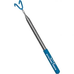 Dynamic Discs Retriever Pole
 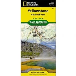 National Geographic 201 Yellowstone National Park Map Idaho Montana Wyoming Gear
  Wilderness Systems Through Hull Wiring Kit
  MSR Pump/Fuel Bottle O-Ring Gear
  National Geographic Gear 3302 Iceland - Adventure Map
 Sale!

National Geographic Gear 709 Wasatch Front Map Utah
Original price was: $11.95.$8.37Current price is: $8.37.
- Buy quality, buy with us.
- Online assistance, always just a message away.
- Peace of Mind with Every Purchase
- Get the quality you deserve, for less.

The National Geographic -Trails Illustrated folded map is your essential guide for outdoor exploration in Utah’s Wasatch Front/Strawberry Valley area. The brilliantly illustrated topographical representation shows all trails, campsites, and recreational features, plus relevant info on wildlife, history, geology, and archaeology.
Coverage includes Uinta National Forest. Southern Wasatch National Forest. Twin Peaks, Lone Peak and Mt. Timpanogos Wildernesses. Spanish Fork, Soldier Summit, Cottonwood Heights, Kamas, Heber City and American Fork. Cottonwood, Mill Creek and Spanish Fork Canyons, Mirror Lake- West, Rockport Lake, Deer Creek, Currant Creek and Strawberry Reservoir.
All data is updated to reflect road closings, new trails, and campground relocation.
Printed on waterproof, tear-resistant material with a plastic coating that offers supreme durablity for your next outdoor adventure.
Measures 4″ x 9″ folded and 28″ x 32″ fully opened. Scale of 1:90,000.
Be the first to review “National Geographic Gear 709 Wasatch Front Map Utah”
Related products
Sale!

Original price was: $14.95.$12.26Current price is: $12.26.
Sale!
Original price was: $11.95.$9.20Current price is: $9.20.
Sale!

Original price was: $14.95.$11.51Current price is: $11.51.
Sale!

Original price was: $11.95.$9.32Current price is: $9.32.
Sale!

Original price was: $11.95.$9.68Current price is: $9.68.
Sale!

Original price was: $11.95.$9.80Current price is: $9.80.
Sale!


Original price was: $7.95.$6.44Current price is: $6.44.
This product has multiple variants. The options may be chosen on the product page
Sale!

Original price was: $14.95.$10.91Current price is: $10.91.
Reviews
There are no reviews yet.