-
×
 Yakima Spare Tire Carrier
1 × $89.25
Yakima Spare Tire Carrier
1 × $89.25 -
×
 Mountain House Chicken Stew Number 10 Can The 10 Essentials
1 × $28.82
Mountain House Chicken Stew Number 10 Can The 10 Essentials
1 × $28.82 -
×
Gear MSR Alpine Spatula V2
1 × $4.17
-
×
Mountain House Gear Mountain Sports Scrambled Eggs With Ham And Peppers
1 × $6.12
-
×
National Geographic Gear 1001 John Muir Trail Map Guid-California
1 × $12.56
 Mountain House Chicken Stew Number 10 Can The 10 Essentials
  Gear MSR Alpine Spatula V2
  Mountain House Gear Mountain Sports Scrambled Eggs With Ham And Peppers
 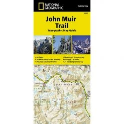 National Geographic Gear 1001 John Muir Trail Map Guid-California
 Sale!

National Geographic The 10 Essentials 106 Kremmling – Granby Map
Original price was: $5.95.$4.94Current price is: $4.94.
- Buy quality, buy with us.
- Online assistance, always just a message away.
- Peace of Mind with Every Purchase
- Get the quality you deserve, for less.

The National Geographic -Trails Illustrated folded map is your essential guide for outdoor exploration in Colorado’s Kremmling/Granby area. The brilliantly illustrated topographical representation shows all trails, campsites, and recreational features, plus relevant info on wildlife, history, geology, and archaeology.
Coverage includes Arapaho National Forest, Arapahoe National Recreation Area. Kremmling, Granby, Hot Sulphur Springs and Parshall. Colorado River, Willow Creek, Windy Gap, Hinman and Williams Fork reservoirs. Antelope, Cottonwood and Gunsight passes. Ski Areas: Silver Creek.
All data is updated to reflect road closings, new trails, and campground relocation.
Printed on waterproof, tear-resistant material with a plastic coating that offers supreme durablity for your next outdoor adventure.
Measures 4″ x 9″ folded and 28″ x 32″ fully opened.
Be the first to review “National Geographic The 10 Essentials 106 Kremmling – Granby Map”
Related products
Sale!


Original price was: $7.95.$6.44Current price is: $6.44.
This product has multiple variants. The options may be chosen on the product page
Sale!

Original price was: $11.95.$9.92Current price is: $9.92.
Sale!

Original price was: $14.95.$12.26Current price is: $12.26.
Sale!

Original price was: $14.95.$10.91Current price is: $10.91.
Sale!

Original price was: $11.95.$9.32Current price is: $9.32.
Sale!

Original price was: $11.95.$8.72Current price is: $8.72.
Sale!

Original price was: $11.95.$9.92Current price is: $9.92.
Sale!

Original price was: $14.95.$12.26Current price is: $12.26.
Reviews
There are no reviews yet.