-
×
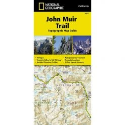 National Geographic Gear 1001 John Muir Trail Map Guid-California
1 × $12.56
National Geographic Gear 1001 John Muir Trail Map Guid-California
1 × $12.56 -
×
 National Geographic Gear 1303 Colorado Topographic Map- 14ers South
2 × $12.26
National Geographic Gear 1303 Colorado Topographic Map- 14ers South
2 × $12.26 -
×
National Geographic Gear 3302 Iceland - Adventure Map
1 × $11.06
-
×
Gear 730 Toas Area National Geographic Map New Mexico
1 × $10.91
-
×
National Geographic Gear 305 SE Yellow - Yellowstone Lake Map Wyoming
1 × $8.72
-
×
National Geographic 1013 Tahoe Rim Trail Map Gear
1 × $11.06
-
×
National Geographic 204 Lake Mead National Recreation Area Map Gear
2 × $10.91
 National Geographic Gear 305 SE Yellow - Yellowstone Lake Map Wyoming
  National Geographic 204 Lake Mead National Recreation Area Map Gear
 Sale!

National Geographic The 10 Essentials 134 Black Mesa – Curecanti Map Colorado
Original price was: $11.95.$10.16Current price is: $10.16.
- Buy quality, buy with us.
- Online assistance, always just a message away.
- Peace of Mind with Every Purchase
- Get the quality you deserve, for less.

The National Geographic -Trails Illustrated folded map is your essential guide for outdoor exploration in Colorado’s Black Mesa/Curecanti Pass area. The brilliantly illustrated topographical representation shows all trails, campsites, and recreational features, plus relevant info on wildlife, history, geology, and archaeology.
Coverage includes Gunnison National Forest. West Elk Wilderness. Curecanti National Recreation Area. Sapinero Wildlife Area. Blue Mesa, Bald Mountain, and Kenny Moore reservoirs, Rainbow Lake and Soap Creek. Curecanti and Storm passes.
All data is updated to reflect road closings, new trails, and campground relocation.
Printed on waterproof, tear-resistant material with a plastic coating that offers supreme durablity for your next outdoor adventure.
Measures 4″ x 9″ folded and 28″ x 32″ fully opened.
Be the first to review “National Geographic The 10 Essentials 134 Black Mesa – Curecanti Map Colorado”
Related products
Sale!

Original price was: $14.95.$10.91Current price is: $10.91.
Sale!

Original price was: $14.95.$11.06Current price is: $11.06.
Sale!

Original price was: $11.95.$9.92Current price is: $9.92.
Sale!

Original price was: $11.95.$9.68Current price is: $9.68.
Sale!

Original price was: $11.95.$9.80Current price is: $9.80.
Sale!

Original price was: $9.95.$8.06Current price is: $8.06.
Sale!

Original price was: $14.95.$12.26Current price is: $12.26.
Sale!

Original price was: $14.95.$11.06Current price is: $11.06.
Reviews
There are no reviews yet.